
Your fiber network, from design to field.
Manage fiber inventory, design decisions and field records together with SoSoMaps. Review planned changes, record construction results and base operational decisions on current network information.
Cloud and on-premises deployment options · public documentation.
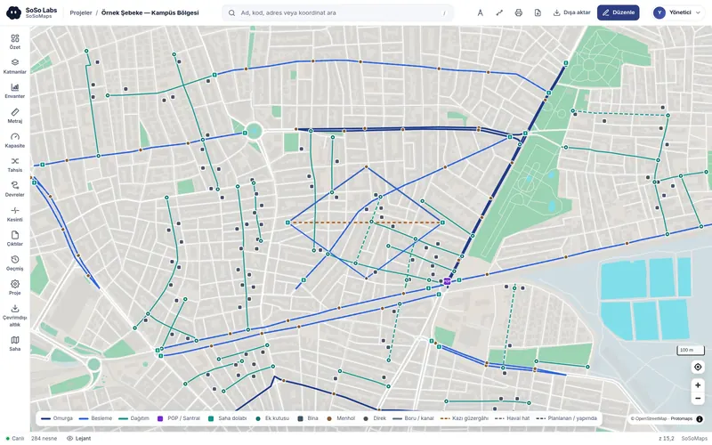
For teams that plan, build and operate fiber infrastructure.
Telecom and infrastructure operators
Track fiber connections, technical circuits and field changes through a shared record.
Organised industrial zones
Maintain current records of local fiber infrastructure and assess maintenance needs and outage impact.
Municipalities
Track your organisation’s fiber routes and site structures together.
Energy distribution companies
Manage communications fiber infrastructure with connection and project records.
Engineering and construction firms
Bring design decisions, as-built records and field handovers together in the same project information.
Turn separate records into shared network information.
Traceable connections
Track each fiber’s route, connections and endpoints in one record.
One current record
Office and field teams track changes in a shared project record, including who made each change and when.
Organisational knowledge
Infrastructure information becomes a lasting organisational record that teams can consult, without depending on individual knowledge.
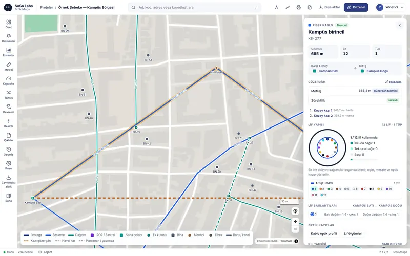
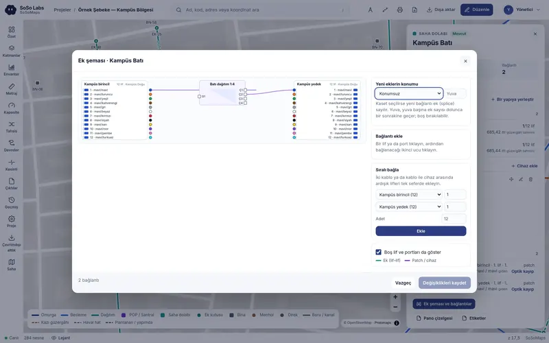
Connected records from the network map to a single fiber.
The cable on the map, its tube structure and the fiber in the splice diagram belong to the same record. Keeping these records together makes it easier to compare drawings with connection information and identify gaps.
Reliable information for critical decisions.
Review designs before applying them
Compare design branches and assess conflicts and change impact before implementation. Review, approval and controlled publication bring the agreed design into the network record.
Explore the design process →Bring field results into the project record
Track construction and as-built records through work packages. Use the offline field application without an internet connection, then bring photos, documents and corrections into the current record through office review.
Explore field work →See circuit paths and shared risks
Assess primary and backup paths together. Use routing constraints, shared physical risks and affected circuits to set maintenance and response priorities.
Explore operations features →Compare investment options
Assess route options by distance, use of existing infrastructure and cost. Compare optical calculations with measurement records and use OTDR data to review estimated fault locations on the network.
Explore planning and measurement →Manage data ownership and access together.
Import existing drawings and lists with checks. Export your data in common formats and move projects to another deployment. With on-premises deployment, you can still view and export your data after the licence expires.
Explore security and data ownership →
Import
Bring drawings and geographic data together; preserve field corrections when importing updates.
Export
Outputs in drawing, list and report formats.
Permissions and audit
Define access through project membership and write access through region and module permissions. Track operations in the change history with user and time information.
Choose a deployment that suits your organisation.
Cloud
Access through a web browser without investing in infrastructure.
On-premises deployment
Your data stays on your organisation’s infrastructure. Also works in environments without an internet connection.
For your fiber network today.
The fiber module brings inventory, design, field work, circuit records and measurement records into the same project.
Fiber
Connect cable, fiber and port records with design, field and operational work.
Explore fiber features →Electric Coming soon
A separate module for electrical infrastructure is in preparation.
Copper Coming soon
A module for copper network records is in preparation.
Coax Coming soon
A module for coax network records is in preparation.
From existing records to shared project information.
Assess your drawings, tables and geographic data together. Define preparation and acceptance work around the condition of your source records.
Identify source files and data owners.
Review the coordinate system and field mappings.
Assess the preview and resulting records.
Make accepted records available to your teams.
Evaluate the product through its documentation.
The user guide and developer documentation are publicly available.
User guide
Explore workflows, screen descriptions and related topics, from your first project to field outputs.
Open the guide →Developer documentation
Review access and data sharing contracts for the API, map publishing and webhook notifications.
Open developer documentation →Published pricing
Review the plan that suits your organisation and use the published prices to prepare your budget.
